
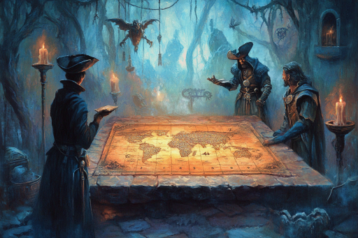


Long before satellites or GPS, ancient civilizations created maps so precise they seem impossible. These artifacts depict coastlines, continents, and even polar regions with shocking accuracy—raising serious questions about the knowledge and technology of the past. Were these maps the result of forgotten explorers, lost civilizations, or something far more mysterious? One thing is certain: these ancient depictions of the world challenge everything we thought we knew about history.
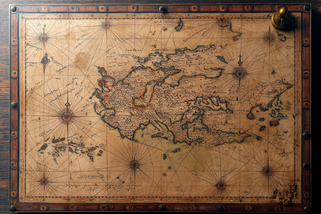
The Piri Reis Map

Discovered in 1513 but believed to be based on much older sources, the Piri Reis Map shows parts of South America and even Antarctica—centuries before the latter was officially discovered. Even more puzzling, it appears to depict the Antarctic coastline without its ice sheet. Scholars are still baffled by how such precise knowledge could exist in the early 16th century. Some believe it was compiled from lost ancient sea charts passed down through forgotten civilizations.
The Tabula Rogeriana
Created by the Arab geographer Al-Idrisi in 1154, this map was centuries ahead of its time in both scale and accuracy. It features remarkably detailed depictions of the Mediterranean, North Africa, and parts of Europe and Asia. What makes it astonishing is the level of geographic knowledge during an era when much of Europe was still shrouded in medieval darkness. The map suggests a far-reaching network of shared ancient knowledge.
The Zeno Map

Published in the 16th century but allegedly based on documents from the 14th, the Zeno Map displays Greenland and parts of North America in incredible detail. Its depiction of longitudes and relative distances between landmasses is so accurate it stunned researchers. Some believe it points to early transatlantic voyages well before Columbus. Others suggest even older sources influenced its design.
The Buache Map

Drawn in 1737 by French geographer Philippe Buache, this map mysteriously shows the subglacial topography of Antarctica—long before modern technology made it possible. It suggests that the continent may have been mapped before it froze over. The implications are staggering: either Buache had access to extremely ancient records, or someone mapped Antarctica under radically different climate conditions.
The Kangnido Map

Created in Korea in 1402, the Kangnido Map features an astonishingly accurate representation of Africa’s shape and size, far ahead of European cartography at the time. It even includes surprisingly well-placed parts of Europe and the Middle East. This level of precision implies that Korean and Chinese scholars may have had access to global knowledge networks now lost to time. Its presence defies the belief that East Asian cartography was isolated or primitive.
The Vinland Map

This controversial map, allegedly from the 15th century, depicts a part of North America labeled as “Vinland”—suggesting Norse exploration of the continent well before Columbus. If genuine, it proves that ancient seafarers reached the New World and documented it. Its authenticity has been fiercely debated, but the accuracy of the landmass continues to fuel curiosity. Even skeptics admit it’s based on remarkably advanced knowledge.
The Da Ming Hun Yi Tu

A Chinese map from the 14th century, the Da Ming Hun Yi Tu covers an area stretching from Africa to Japan. Its proportionate representation of continents and relative positioning is unusually precise for its time. It demonstrates not just geographic knowledge but a global worldview centuries before such a concept was widely accepted. Scholars wonder what sources informed such a sweeping and detailed creation.
The Hadji Ahmed Map

Dating to the 16th century and created by a Turkish cartographer, this map shows North and South America with remarkable accuracy. Some elements even suggest a familiarity with inner regions of the Americas, not just coastlines. It challenges the notion that this information was unavailable outside of European explorers. Did Ahmed have access to ancient, pre-Columbian sources?
The Ebstorf Map

This massive circular map from the 13th century places Jerusalem at its center but includes an extraordinary amount of detail about Asia, Europe, and Africa. It’s part symbolic and part geographic, yet the proportions and placements of lands are surprisingly close to reality. Despite its religious overtones, the Ebstorf Map preserves geographic knowledge that might have roots in far older traditions.
The Reinel Map

Drawn around 1504 by Portuguese cartographer Pedro Reinel, this map includes an accurate depiction of the African coastline and even early versions of the South American coast. What stands out is its use of compass lines and proportional accuracy, innovations that shouldn’t have existed at that time. It’s as if Reinel had access to knowledge from a long-lost maritime culture.
The Portolan Charts

Portolan charts, beginning in the 13th century, show Mediterranean coastlines with an almost GPS-level precision—centuries before such technology existed. These nautical maps include compass roses, wind directions, and coastal landmarks that were used for navigation across open seas. No one knows how such accuracy was achieved so early. Some theorize they were based on much older, possibly ancient, seafaring records.
The Salviati Planisphere

This 16th-century map features surprisingly accurate depictions of both North and South America—at a time when much of the interior remained unexplored. The placement of major river systems and mountain ranges implies first-hand knowledge or ancient guidance. How this cartographer managed such accuracy is still debated. It’s one of the clearest examples of knowledge seemingly ahead of its time.
The Camaldolese Map

Drawn in the early 1500s by a group of Italian monks, the Camaldolese Map shows remarkably accurate outlines of Europe and Asia. It includes locations that were supposedly unknown to Europeans at the time, suggesting either an extensive spy network or access to ancient geographic sources. Its precision in terrain features defies expectations for a religious order of the time. Was it divine inspiration—or forgotten science?
The Ibn Hawqal Map

Created by a 10th-century Muslim scholar, this map includes detailed representations of the Mediterranean and the Islamic world. But what’s most shocking is its accuracy in depicting the Niger River’s flow—something not confirmed by European explorers until nearly 900 years later. Ibn Hawqal’s map suggests a deeply rooted, advanced understanding of geography long before modern cartography emerged.
The Mahabharata Earth Diagram

While more symbolic than literal, this ancient Hindu depiction of the Earth aligns shockingly well with the layout of real-world continents when scaled and adjusted. Found in interpretations of India’s ancient texts, it suggests a conceptual awareness of global geography. Some scholars believe it’s a mythologized representation—but others argue it preserves a memory of real, ancient knowledge. Could this be a map disguised as a cosmic tale?
Secrets Hidden in the Ink of Time

These maps are more than curiosities—they’re clues pointing to a deeper, older narrative of human civilization. Their existence suggests ancient peoples may have been far more advanced, connected, and well-traveled than we’ve been taught. Whether these maps are the result of lost technology, erased history, or encounters with the unknown, they leave us questioning what else has been forgotten. Perhaps the world was never as disconnected as we once believed.