History is written by those who record it—but what if the maps of the past tell a different story? Ancient charts and navigational records suggest civilizations had knowledge of lands, coastlines, and continents long before their “official” discoveries. Some depict ice-free Antarctica, others hint at forgotten trade routes, and a few even suggest contact between cultures separated by oceans. These maps challenge the boundaries of what we thought we knew and leave us wondering just how much history has been lost to time.
The Piri Reis Map: Antarctica Before It Was ‘Discovered’

Drawn in 1513, the Piri Reis Map contains an astounding anomaly—an outline of Antarctica without ice, centuries before it was officially discovered. The coastline matches modern surveys of the landmass beneath the ice, suggesting ancient seafarers might have mapped it thousands of years ago. How could a 16th-century Turkish admiral possess such precise geographical knowledge? Some believe he copied from much older sources, now lost to history.
The Vinland Map: Proof of Viking Exploration?

Long before Columbus, the Vikings may have charted North America. The Vinland Map, allegedly from the 15th century, shows a landmass west of Greenland labeled “Vinland”—matching Norse sagas of Leif Erikson’s journey. While some experts claim it’s a forgery, others argue its ink and parchment align with medieval materials. If authentic, it rewrites the timeline of European contact with the New World.
The Kangnido Map: A 14th-Century View of the World

Created in 1402, the Kangnido Map was centuries ahead of its time, displaying Africa, Europe, and even a surprisingly detailed Middle East. This early Korean world map suggests advanced global awareness before European explorers set sail. Some scholars believe it was influenced by ancient Chinese knowledge, proving that East Asia had access to geographical data long before the Age of Discovery.
The Zeno Map: A Secret Knowledge of America?
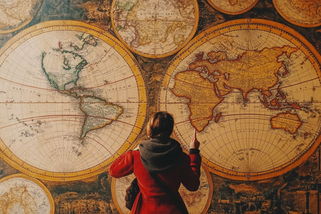
The Zeno Map, published in 1558, claims to be based on much older documents from Venetian explorers who sailed to North America in the 14th century. It depicts Greenland and parts of Canada with surprising accuracy, despite being drawn long before official European maps of the region. Was this knowledge suppressed, or did an unknown seafaring civilization reach the New World before Columbus?
The Tabula Rogeriana: An Islamic Map of the World

Created in 1154 by Al-Idrisi, the Tabula Rogeriana was the most advanced world map of its time. Unlike European maps, it placed south at the top and included precise details of Africa, the Middle East, and Asia. This Islamic cartographer’s work influenced navigators for centuries, proving that advanced geographic knowledge thrived in medieval Islamic civilization.
The Dulcert Map: A Glimpse at Lost Knowledge

Drawn in 1339, the Dulcert Map is considered one of the most detailed medieval nautical charts, accurately depicting the Atlantic coasts of Europe and Africa. But its real mystery lies in its depiction of islands that don’t exist on modern maps. Were these simply cartographic errors, or evidence of lost lands now submerged beneath the waves?
The Cantino Planisphere: A Forbidden Map?

Smuggled out of Portugal in 1502, the Cantino Planisphere contained groundbreaking geographical details, including an early depiction of Brazil. At a time when exploration was a tightly guarded secret, how did this map find its way into foreign hands? Some speculate that ancient knowledge of the Americas influenced early explorers far more than official history admits.
The Hereford Mappa Mundi: A Map of Myth and Reality

The Hereford Mappa Mundi, created around 1300, blends geography with mythology, depicting strange creatures, biblical events, and real-world locations. Though seemingly fantastical, some scholars believe it contains hidden truths about forgotten lands and trade routes. Was this medieval map a coded record of ancient knowledge disguised in legend?
The Da Ming Hun Yi Tu: A 14th-Century Glimpse at the Americas?

This massive 14th-century Chinese map, known as the Da Ming Hun Yi Tu, displays an astonishingly accurate world outline. Some researchers claim faint landmasses resemble parts of the Americas—long before Columbus or Zheng He’s legendary voyages. Could ancient Chinese explorers have reached the Pacific coasts of North or South America?
The Hadji Ahmed Map: A Lost Cartographic Legacy

Published in 1559, the Hadji Ahmed Map presents a world far ahead of its time, including an uncanny depiction of the western coastline of Australia. Since Europeans wouldn’t officially land there until the 17th century, this raises questions about early, undocumented explorations. Was this knowledge inherited from an ancient civilization?
The Buache Map: Ice-Free Antarctica?

The Buache Map, drawn in the 18th century, is controversial for one reason—it shows Antarctica’s landmass without ice, something geologists only confirmed with modern radar technology. Some believe it was based on far older sources, suggesting ancient civilizations may have mapped the continent when it was warm and ice-free. If true, this would change our understanding of early human exploration.
The Carte de l’Amerique: A Forgotten Connection?

A 16th-century French map, the Carte de l’Amerique, shows details of the Mississippi River before Europeans officially explored it. Some believe this suggests that indigenous knowledge was passed to mapmakers long before history acknowledges. Could this be evidence of hidden interactions between Old and New World civilizations?
The Portolan Charts: The Maps That Shouldn’t Exist

Portolan charts from the 13th to 16th centuries are stunningly accurate, detailing coastlines and distances as if mapped by satellites. Created without modern longitude calculations, they remain a mystery—how did medieval sailors navigate with such precision? Some suggest lost knowledge of advanced ancient navigation techniques, hinting at a forgotten age of exploration.
Are We Following a Map We No Longer Understand?

Maps are more than just guides—they are records of how civilizations understood the world. But when maps reveal knowledge that should have been impossible for their time, it forces us to reconsider what history has hidden. Could these charts be remnants of an advanced, forgotten past? Perhaps the greatest journeys aren’t the ones we take—but the ones we rediscover.

